What's In a Name?
 Written by
Harold
Written by
Harold
- Published in Stories and Articles
- Read 9063 times
- font size decrease font size increase font size
Have you ever wondered how the places you have fished, or otherwise visited on and around Great Bear Lake came by their names?
I certainly have.
Not being one who subscribes to the theory that ignorance is bliss – well, most of the time anyway - I started doing some research with the intention of finding the origins of as many place names as possible.
Many of the "official" names were given by English or French-speaking explorers, missionaries, surveyors, geologists, and in a number of cases, were taken from maps submitted with recorded mining claims.
The "official" names notwithstanding, the local people had already named many of the places and features in their own language, therefore I have included traditional Dene, and Northern Slavey place names whenever possible.
I have also included some unofficial place names that have been conferred on various landmarks and features by guides and fishermen over the years.
The compilation of this list remains a work in progress, therefor if you happen know the origins of any other place names in and around Great Bear Lake – official or otherwise - please forward them to us, and we will gladly add them to our list.
For your convenience we have included an interactive map pinpointing all of the locations on our list at the end of this article.
Katseyedie River
The traditional name for this river means "Shine On."
In the "Report on the Topography and Geology of Great Bear Lake to Great Slave Lake," by J. Mackintosh Bell, at p.13 he reports, "[t]his is probably the Katseyedie River of Émile Petitot's map, and if it is this stream, its source is in a large lake to the north called Petitot Lake or Lac des Bois."
A review of current topographical maps would appear to place the source of this river in Kilekale Lake, rather than Lac des Bois, which also appeared on Émile Petitot's map.
On the other hand, while not readily apparent, perhaps it does connect with Lac du Bois in some way – after all he was there.
Kroger Island
Named to commemorate the memory of Annemarie Kroger. Originally from Hamburg, Germany and employed by the Geographical Branch in 1960, she drowned in July of that year in this area, while carrying out field-research for the Geographical Branch and the Arctic Institute.
Deerpass Bay
Named by Sir John Franklin during his second overland expedition, 1825 – 1827. The traditional place name is Narre ella.
Ford Bay
Name was submitted by F.H. Peters, Surveyor General, and taken from field maps.
Goodfellow Point
Commemorates Joan Goodfellow, who was born in Plaster Rock, NB, and employed by the Geographical Branch in 1960.
Joan, together with Annemarie Kroger, drowned in that same year while carrying out research for the Geographical Branch and the Arctic Institute.
Additional information regarding this unfortunate incident can be found here
Good Hope Bay
Submitted February 16, 1924 by H.E. Pearson, Dominion Land Surveyor, as an alternative name for what was known then as Smith Bay. The traditional Dene name is Ịturotǫ.
In the early 1900's, Inspector Charles Deering “Denny” LaNauze of the RCMP, commented that the name “Good Hope” came from the fact that the area was regularly frequented by Indians from Fort Good Hope.
Hook River
A small river that flows into the Coppermine River at the "Big Bend."
Hook was the chief of the Yellowknives (Copper Indians), who travelled with Sir John Franklin for a time during his first overland expedition from 1819 to 1822.
Hottah Lake
The traditional Dene name is Itseretué, meaning "Two Year Old Moose."
Macintosh Bay
Named for geologist, James Macintosh Bell.
McGill Bay
Annemarie Kroger, geologist with the University of McGill in Montreal, named it "…after our University. Our last camp was here…"
Clearwater Bay
Named by Annemarie Kroger, who said, "With its sandy shores and clear water, it stands in contrast to the bays east of it."
Blood Creek
Taken from a sketch map made by John Hornby.
Colville Lake
Named by Sir John Colville, Governor of the Hudson's Bay Company from 1852 to 1856.
The community was formed in the 1960's, when people moved into the area on a permanent basis to trap.
Bern Will Brown, Artist, and Missionary Oblate of Mary Immaculate, established a mission at Colville Lake at that time. The traditional Dene name is K'áhbamįtúé.
Echo Bay
Named for Echo Bay Mines, who used the site for mining after the original settlement of Port Radium had been abandoned.
The official name change from Port Radium to Echo Bay took place on January 7, 1975.
Tulita
"Where the waters meet," is the place where the Great Bear River empties its waters into the Mackenzie.
Once called Fort Norman, it was the site of a Hudson's bay trading post established in 1851.
The name was changed back to its traditional Northern Slavey name in 1996.
Douglas Bay
Named for mining engineer George M Douglas, author of "Lands Forlorn."
Ekka Island
Dene name meaning, "Caribou Fat."
Gossan Island
Submitted by M.G. Cameron, from a sketch provided by Dr. A.E. Cameron, Professor of Mining, University of Alberta.
Great Bear River
Translation of the Dene name Saschohetha, or Sahtú Dé.
The name was first applied because of the many bears seen in the area.
Grizzly Bear Mountain
Translation of the traditional Northern Slavey name – Saoyú.
Hunter Bay and Hornby Bay
Submitted by M.G. Cameron.
Ikanyo Island
Dene name meaning "treeless" island.
Leith Peninsula
This name was provided by Isidore Yukon from Deline, who hunted and trapped in the area.
Whitefish River
Translation of traditional Dene name - Luedehk' aledeh.
Cosmo Creek
Named for Cosmo Melvill, John Hornby's companion from 1908 to 1911.
Crosswise Island
The name came from a map of Great Bear Lake produced by Dr. Miller of the Fisheries Research Board, where he referred to it as, "Crosswise of the Lake Island."
Dease River
Named by John Rae for Peter Warren Dease, Chief Factor of the Hudson's Bay Company.
Drybrough Lake
Named after J. Drybrough, a consulting mining engineer who worked in the Great Bear area.
Etacho Point
Emile Petitot's name for the Scented Grass Hills peninsula.
Scented Grass Hills
Translation of traditional Northern Slavey name.
It was referred to as Gai-et-Thella Hill at one time, but on todays maps is better known as ?ehdacho.
Good Hope Ridge
If you have ever fished the Smith arm, it would be hard to miss the distinctive ridge that forms the west shore of Good Hope Bay.
The ridge runs north, all the way to the southern extreme of Lac des Bois.
The Geological Survey proposed the name.
Haldane River
Named after John Haldane, a Chief Factor with the Hudson's Bay Company.
Hunter Bay
The name was submitted by M.G. Cameron, Dominion Land Surveyor - (DLS).
Lindsley Bay
Submitted by G.E.B. Sinclair, and taken from a Lands Division Mineral Claim Sheet.
Mystery Island
Submitted by M.G. Cameron, DLS, May 27, 1932.
Richardson Island
Named after John Richardson, Surgeon and Naturalist with both of Franklin's land expeditions. He also commanded a boat expedition in 1848, in the search for Franklin.
Sloan River
Submitted in May 1932 by M.G. Cameron, DLS, and named after prospector Charles Sloan
Spud Bay
The Surveyor General submitted this name in 1936 as the name shown on mining claims in that area.
Lac Ste. Thérès
Named for his mother by Father Émile Petitot, O.M.I. The traditional place name is Kotcha – troué or Shelter Lake.
Sawmill Bay
There was a sawmill located in the area, likely built in the early 1930's and owned by Murphy Services who operated out of Cameron Bay.
The mill was used to supply timbers for the mine (Eldorado) and lumber for buildings.
Johnny Hoe River
The traditional place name is Toué – niliné or River of Lakes. Named for a Sahtú Dene man who is buried in the area.
Clut Lake**
Lake on the Camsell River system likely named after Oblate, Coadjutor Bishop, Isidore Clut, who travelled extensively in the area.
Grouard Lake**
Lake just south of Clut Lake on the Camsell River system likely named after Father Émile Grouard, O.M.I.
Naiju or Karkegie River*
Located on the south shore of the Smith Arm about half way between Ford and Macintosh Bay's it is reputed to be the final resting place for a legendary Dene man Karkegie (alternative spelling is Karkeye) who was said to have powerful medicine.
According to his great grandson George Baton, he was buried here so that he could watch people pass by.
Cameron Bay*
While I have been unable to find any definitive proof, my bet is that it was named after M.G. Cameron, DLS, given that he did some extensive survey work in the area.
In addition, Charles Camel in his book, Son of the North, states that the bay was named after Jack Cameron a prospector who staked a number of claims in the area in 1931.
Tripod Point*
Name given to a point, or rather series of points, on the north shore of the Smith Arm approximately 20 miles west of the Katseyedie River.
A guest at Trophy Lodge erected a tripod on the western most point, to mark the place where he had hooked, and lost, the biggest lake trout he had ever seen.
Great Bear Lake*
Well what about the big lake itself?
Some have said that it takes its name from the constellation Ursa Major - the Great Bear. Perhaps, but I personally prefer this version, as recounted to Cornelius B. Osgood by a Dene elder in 1931.
The story was subsequently included in the annual report to the Government of Canada from the National Museum of Canada:
"Great Bear Lake is said to have taken it's name from a fabulous bear which lived near the shore of Bear Mountain.
The Satudene state that once upon a time an Indian near that place shot a bear cub and, putting it into his canoe, started to paddle away. While he did so a Great Bear appeared and said, "Give me back my child."
This Indian refused to do, so the Great Bear warned him, "Then never camp alone." The Indian always remembered and obeyed this injunction until one night long afterwards, when he was forced to camp by himself, having become separated from his party.
He camped on an island, but it had no sooner become dark than the Great Bear appeared and stood over the sleeping man. "Now I am going to kill you," he said. The Indian awakened, and answered him shrewdly, "Then do it without making me suffer. Take my head in your mouth and crush it with your jaws."
This the Great Bear agreed to do, but no sooner had it taken the Indians head into it's mouth than the native's medicine, which was the Northern Lights, began to work in such a fashion that the man's head swelled, and the Great Bear was unable to crush it.
Further, the Northern Lights, radiating from the native's head through that of the Bear, paralysed the memory and demented the great animal, whereupon the Indian extricated himself from his predicament and made a hurried departure in his canoe, only hesitating to make the sarcastic remark, I thought you were going to kill me?"
Fenway Park*
This name was conferred by guides at Trophy lodge to describe an area featuring a wall of bright green cliffs located on the north shore of the lake between Tripod Point and Good Hope Bay. If you use your imagination, it does bear something of a resemblance to the famous "Green Monster" of Fenway Park fame in Boston.
Ross Point*
Name given to the western most point of land on Ekka Island by none other than Arthur Ross himself.
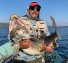
This point produced some very big fish in the forty-pound range for Arthur one evening, and then subsequently gave up a fifty pounder the following day.
This area is definitely worth fishing if you should ever find yourself in the Ekka Island area.
* Unofficial Place Name
** The information I have gathered came from the book, The Oblate Assault on Canada’s Northwest. While not confirmed, I suspect my suppositions are correct in that the Oblates established missions and travelled extensively throughout the area where these lakes are to be found.